You're now following
Error following user.
This user does not allow users to follow them.
You are already following this user.
Your membership plan only allows 0 follows. Upgrade here.
Successfully unfollowed
Error unfollowing user.
You have successfully recommended
Error recommending user.
Something went wrong. Please refresh the page and try again.
Email successfully verified.


rawalpindi, pakistan
It's currently 10:59 AM here
Joined November 22, 2018
5 Recommendations
Mubeen S.
@smubeeen
6.5
6.5
92%
92%

rawalpindi, pakistan
99%
Jobs Completed
98%
On Budget
96%
On Time
10%
Repeat Hire Rate
GIS, Remote Sensing & Mapping Enthusiast
Contact Mubeen S. about your job
Log in to discuss any details over chat.
Portfolio
Portfolio


GIS-Based Dashboard


Fiber to the Home(FTTH) network planning

Fiber to the Home(FTTH) network planning


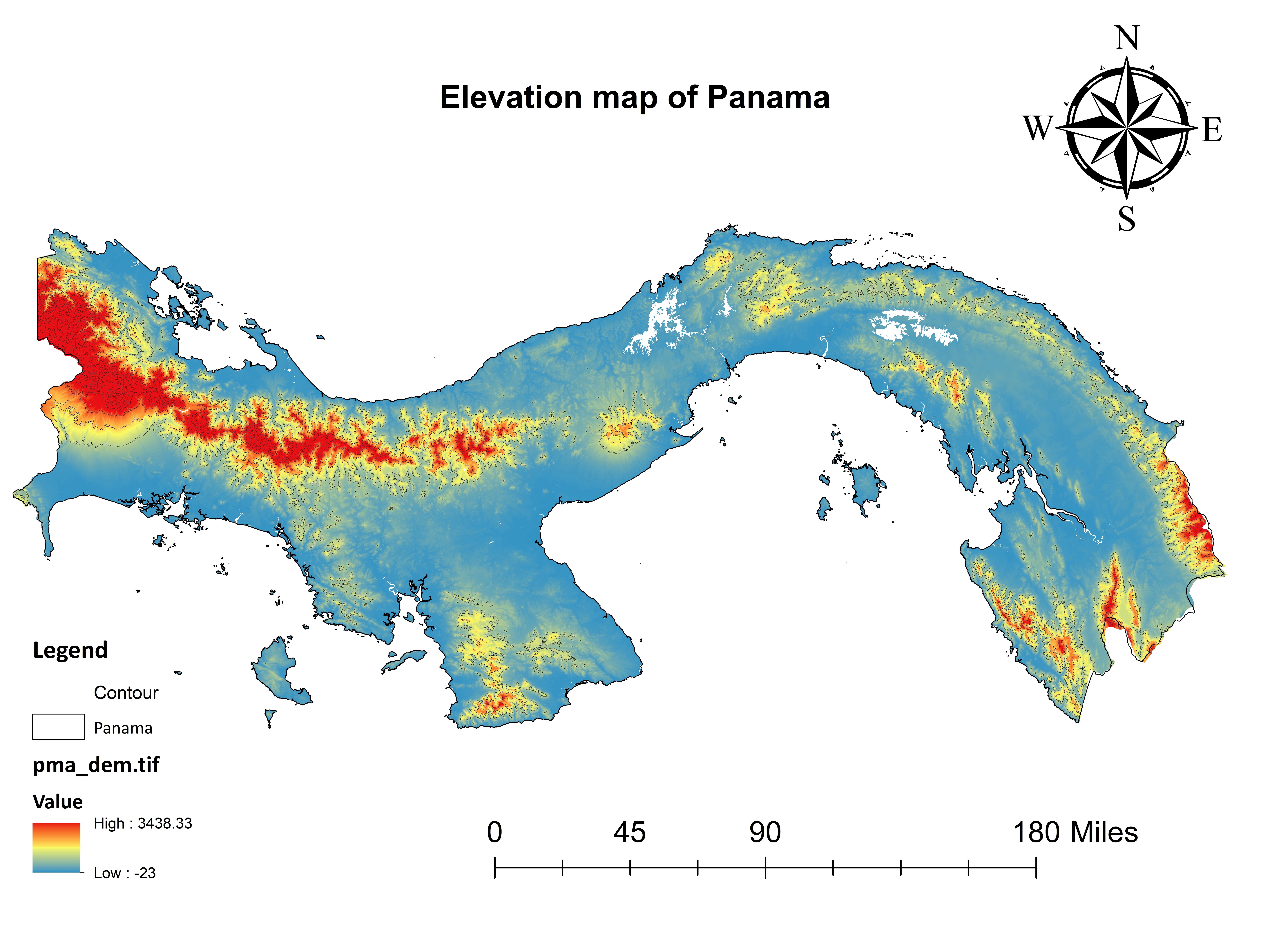
Elevation & Rainfall map of Panama for Botanical Exploration

Elevation & Rainfall map of Panama for Botanical Exploration


Using Service Area Analysis for Tourist Estimation

Using Service Area Analysis for Tourist Estimation

Using Service Area Analysis for Tourist Estimation


Developing a Clustering Webmap for COVID-19 using ARCGIS API

Developing a Clustering Webmap for COVID-19 using ARCGIS API

Developing a Clustering Webmap for COVID-19 using ARCGIS API


Digitizing footprints and Masterplans for Real Estate


GIS-Based Dashboard


Fiber to the Home(FTTH) network planning

Fiber to the Home(FTTH) network planning


Elevation & Rainfall map of Panama for Botanical Exploration

Elevation & Rainfall map of Panama for Botanical Exploration


Using Service Area Analysis for Tourist Estimation

Using Service Area Analysis for Tourist Estimation

Using Service Area Analysis for Tourist Estimation


Developing a Clustering Webmap for COVID-19 using ARCGIS API

Developing a Clustering Webmap for COVID-19 using ARCGIS API

Developing a Clustering Webmap for COVID-19 using ARCGIS API


Digitizing footprints and Masterplans for Real Estate
Reviews
Changes saved
Showing 1 - 5 out of 50+ reviews
$200.00 USD
Cartography & Maps
Google Earth
Geospatial
Dthreejs
Data Science
R

•
$110.00 USD
Excel
Cartography & Maps
Geolocation
Geospatial
Dthreejs
N

•
$90.00 USD
Cartography & Maps
ArcMap
R

•
$50.00 AUD
Cartography & Maps
Google Earth
Geospatial
Google Maps API
+1 more
E

•
$140.00 USD
Cartography & Maps
Statistical Analysis
Data Science
Geographical Information System (GIS)
ArcGIS
B

•
Experience
GIS Specialist
Jun 2022 - Present
GIS Based Mapping
Automating GIS Workflow
Satellite Image Processing
Providing Solutions and Methodologies
Designing Maps
Telecom Infrastructure Planning
GIS and Remote Sensing Developer
Dec 2019 - Apr 2022 (2 years, 4 months)
Managing Geodatabases
Utilize Python scripting to automate GIS workflows
Cartography
Matlab
Glaciers Monitoring
Maintaining, updating, and creating geospatial databases
Education
Geo-Informatics
(4 years)
Qualifications
Environmental Activist Award
Intergovernmental Panel on Climate Change
2019
.
ESRI certified Anaylst
ESRI Organization
2019
Contact Mubeen S. about your job
Log in to discuss any details over chat.
Verifications
Certifications
Top Skills
Browse Similar Showcases
Invite sent successfully!
Thanks! We’ve emailed you a link to claim your free credit.
Something went wrong while sending your email. Please try again.
Loading preview
Permission granted for Geolocation.
Your login session has expired and you have been logged out. Please log in again.