Find Jobs
Hire Freelancers

Plot and Digitize a Map in Arcgis

₹600-1500 INR

Closed
Posted over 4 years ago

₹600-1500 INR

Paid on delivery
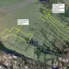
Plot a map in ArcGis and digitize geological faults and contacts from an image.
Project ID: 22415020

About the project

18 proposals
Remote project
Active 4 yrs ago

Looking to make some money?

Benefits of bidding on Freelancer

Set your budget and timeframe
Get paid for your work
Outline your proposal
It's free to sign up and bid on jobs
18 freelancers are bidding on average ₹3,769 INR for this job
User Avatar
Greetings! I have got your job posting “Plot a map and digitize in arcmap” and I am very much interested to work in your project. I am a GIS developer and Cartographer and have more than 2 years experience of working with the Geographic information system, Remote sensing, Cartography, WebGIS, Python and All types of GIS Softwares. i have done several of similar projects So, I think you’ll find that, I have the skills you’re looking for. For more on my skills and successfully finished projects, please have a look on my Profile and Portfolio. I have paid versions of all the Softwares available here with me so i will develop a prototype according to your specifications and then send you the results and files so things will work for sure.I will remotely guide you and help you with GIS tasks. I am always available on Email and Skype. Please have a voice or video chat if necessary. I shall be available round the clock and able to start your project as soon as possible according to you. Thank you for your consideration, Best Regards, Mubeen Shafqat
₹750 INR in 2 days
5.0 (73 reviews)
6.2
6.2
User Avatar
Dear Sir/ Madam, My professional experience includes designing, data collecting, maintaining and updating GIS databases, converting complex data into information that is easily readable and accessible to the general public, creating highly accurate maps and developing database management systems(DBMS). Here are some highlights of my qualifications in experience: • Master’s degree in Geo-informatics at Post Graduate Institute of Agriculture, University of Peradeniya • Earned a bachelor’s degree in Agricultural Technology and Management from University Of Peradeniya ...................................| Expertise in below Software |...................................... - ArcMap - AutoCAD - ArcGIS Pro - CorelDraw - Web App-builder for ArcGIS - Adobe Photoshop - Operational Dashboard For ArcGIS - Adobe illustrator - Survey123 for ArcGIS - Ms Excel - Q-GIS - Ms office
₹1,250 INR in 1 day
4.9 (73 reviews)
6.5
6.5
User Avatar
Hello! I graduated from AGH (Poland) and IFNTUOG (Ukraine). I have master degree in GIS and Cartography. I can help you. I use ArcGIS for a long time. Best Regards Michael
₹3,000 INR in 7 days
5.0 (98 reviews)
6.6
6.6
User Avatar
Hi there! I'm a GIS expert and I've been digitized various geological maps for my studies using GIS techniques and ArcGIS software. You can take a look at my portfolio, I have there some samples and even a geological map.
₹1,500 INR in 4 days
5.0 (28 reviews)
5.9
5.9
User Avatar
Hi We have read and understand the nature of work. it's doable and in our domain. Allow us to complete it. Regards
₹1,500 INR in 1 day
4.9 (29 reviews)
5.1
5.1
User Avatar
This is very simplest task for me. I can complete your work within one day. I am newbee over here but I have more than 10 years work experience at ArcGIS.
₹600 INR in 1 day
4.9 (30 reviews)
5.2
5.2
User Avatar
Hello, I am a Geomatics engineer and Gis Consultant. I have good knowledge about digital mapping, gis applications, point clouds cad works, etc. I can create this map as you wish. I have all the necessary software and knowledge about this. Waiting to hear from you. Kind regards. Bayazıt Murat
₹1,200 INR in 7 days
5.0 (17 reviews)
5.0
5.0
User Avatar
I'm volunteer at GISTURIS organisation, my duties is to digitize rivers from topographic maps. I have 1 year experience in digitizing, and I was GIS Trainee for 3 months in Turkey.
₹1,000 INR in 3 days
5.0 (4 reviews)
4.0
4.0
User Avatar
Greetings! I can help you in mapping geological faults and contacts with formation labeling and symbolization. 1. Can you please share your images for review. I am a digital Cartographer and GIS analyst having experience in creating Topo Maps, Land use maps, Geological maps, thematic maps and spatial data visualisation. I will be happy and adhere to hear back from you, thanks. Hamid
₹1,750 INR in 2 days
4.9 (3 reviews)
3.3
3.3
User Avatar
Hello. I am a GIS(Geographical Information System) expert and Web&Mobile(iOS, Android) developer. I graduated GIS special education course and I am working on the ArcGIS SDK, Geoserver, Google Maps, OSM, Mapbox SDK, OpenLayers and Leaflet, Potree/PointCloud, PostGIS/PostgreSQL, Sqlite/Spatialite etc. I checked your requirement and I think I can do your project. I am very interesting and if you want to work with me, please contact me. I will wait for you and thank you.
₹7,000 INR in 2 days
5.0 (1 review)
2.2
2.2
User Avatar
regards I am a GIS draftman. I am interested in your project. let me help you. thank you
₹1,050 INR in 3 days
0.0 (0 reviews)
0.0
0.0
User Avatar
I have complete my Doctoral degree in the field of Remote Sensing ang GIS from JNU, New Delhi in 2019. At present, working on Research Associate post in a University in Delhi.
₹1,050 INR in 7 days
0.0 (0 reviews)
0.0
0.0
User Avatar
After looking at the project's description i am confident that i can deliver a good results After i digitize the maps in arcgis, i can convert the shp to kml so i can customize the file in google earth i hope to hear good news from you Thank you
₹1,500 INR in 2 days
0.0 (0 reviews)
0.0
0.0
User Avatar
i can do this , i want to know area of interest, i will use google earth pro for doing this. based on the area of interest it may take time.
₹2,000 INR in 2 days
0.0 (0 reviews)
0.0
0.0
User Avatar
Dear Hiring Manager, Let me know if you need higher end work in this regard. I have years of experience in GIS and I can get you on track with anything you need from digitizing to Python scripts to automate your workflow. Thanks so much for your consideration, Drew Derderian
₹40,000 INR in 7 days
0.0 (0 reviews)
0.0
0.0
User Avatar
Hi, I'm Pilar Garcia and I'm environmental engineer. I'm a passion person with GIS, also I have a professional ArcGIs course in Master GIS institute. I would like to help you. I'm a responsable professional and I use ArcGIs for a long time.
₹600 INR in 7 days
0.0 (0 reviews)
0.0
0.0
User Avatar
I have experience in Arcgis for more than 10 years so I can do this project well within the timeline in a 100 percent accuracy.
₹1,050 INR in 7 days
0.0 (0 reviews)
0.0
0.0

About the client

Flag of INDIA
Faridabad, India
5.0
5
Member since Feb 15, 2018

Client Verification

Thanks! We’ve emailed you a link to claim your free credit.
Something went wrong while sending your email. Please try again.
Registered Users Total Jobs Posted
Freelancer ® is a registered Trademark of Freelancer Technology Pty Limited (ACN 142 189 759)
Copyright © 2024 Freelancer Technology Pty Limited (ACN 142 189 759)
Loading preview
Permission granted for Geolocation.
Your login session has expired and you have been logged out. Please log in again.